Back جراسيوسا ARZ Грасіёза Byelorussian Graciosa (Açores) Catalan Ilha Graciosa CEB Graciosa Czech Graciosa Danish Γκρασιόσα Greek Graciosa English Isla Graciosa Spanish Graciosa Estonian
| Graciosa | |
|---|---|
 | |
| Gewässer | Atlantischer Ozean |
| Inselgruppe | Azoren |
| Geographische Lage | 39° 2′ 38″ N, 27° 59′ 1″ W |
 | |
| Länge | 10 km |
| Breite | 7 km |
| Fläche | 60,84 km² |
| Höchste Erhebung | 402 m |
| Einwohner | 4301 (2016) 71 Einw./km² |
| Hauptort | Santa Cruz da Graciosa |
 | |
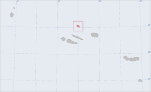
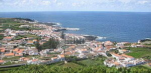
Graciosa (deutsch: zierlich) ist die zweitkleinste Insel der Azoren. Sie bildet zusammen mit Faial, Pico, São Jorge und Terceira die Zentralgruppe des Archipels und liegt in dessen Norden. Die Insel umfasst eine Fläche von 60,84 km² und hat eine annähernd ovale Form. Die größte Nord-Süd-Ausdehnung beträgt 10 Kilometer, die größte Ost-West-Ausdehnung 7 Kilometer. Hauptort der Insel ist Santa Cruz da Graciosa mit etwa 1.800 Einwohnern (Zensus 2011). In den letzten Jahren scheint die durch die rein landwirtschaftliche Wirtschaftsweise bedingte Arbeitsemigration gestoppt.